


WESTWARD HO Voting District, Maricopa County, Arizona
About
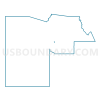
Outline

Summary
| Unique Area Identifier | 524621 |
| Name | WESTWARD HO Voting District |
| County | Maricopa County |
| State | Arizona |
| Area (square miles) | 0.38 |
| Land Area (square miles) | 0.38 |
| Water Area (square miles) | 0.00 |
| % of Land Area | 100.00 |
| % of Water Area | 0.00 |
| Latitude of the Internal Point | 33.45545260 |
| Longtitude of the Internal Point | -112.08059890 |
Maps


Graphs
Select a template below for downloading or customizing gragh for WESTWARD HO Voting District, Maricopa County, Arizona


Neighbors
Neighoring Voting District (by Name) Neighboring Voting District on the Map
- CAPITOL SCHOOL Voting District, Maricopa County, AZ
- DUNBAR Voting District, Maricopa County, AZ
- ENCANTO Voting District, Maricopa County, AZ
- LOWELL Voting District, Maricopa County, AZ
- MCKINLEY Voting District, Maricopa County, AZ
- MONROE Voting District, Maricopa County, AZ
- PALMCROFT Voting District, Maricopa County, AZ
- WILSHIRE Voting District, Maricopa County, AZ
Top 10 Neighboring County Subdivision (by Population) Neighboring County Subdivision on the Map
Top 10 Neighboring Place (by Population) Neighboring Place on the Map
Top 10 Neighboring Elementary School District (by Population) Neighboring Elementary School District on the Map
Top 10 Neighboring Secondary School District (by Population) Neighboring Secondary School District on the Map
Top 10 Neighboring State Legislative District Lower Chamber (by Population) Neighboring State Legislative District Lower Chamber on the Map
- State House District 16, AZ (247,146)
- State House District 14, AZ (158,881)
- State House District 15, AZ (155,897)
Top 10 Neighboring State Legislative District Upper Chamber (by Population) Neighboring State Legislative District Upper Chamber on the Map
- State Senate District 16, AZ (247,146)
- State Senate District 14, AZ (158,881)
- State Senate District 15, AZ (155,897)
Top 10 Neighboring 111th Congressional District (by Population) Neighboring 111th Congressional District on the Map
Top 10 Neighboring Census Tract (by Population) Neighboring Census Tract on the Map
- Census Tract 1129, Maricopa County, AZ (4,805)
- Census Tract 1131, Maricopa County, AZ (2,808)
- Census Tract 1141, Maricopa County, AZ (2,401)
- Census Tract 1130, Maricopa County, AZ (1,895)
- Census Tract 1143.01, Maricopa County, AZ (1,570)